Search Cecil County Property Records
Cecil County property records are filed with the Circuit Court Clerk in Elkton and assessed by the State Department of Assessments and Taxation. Deeds, mortgages, plat maps, and assessment data for Cecil County are searchable online through state systems, with most records available at no charge after a free account registration.
Cecil County Overview
Cecil County Land Records Online
The Maryland Land Records portal is the primary online source for Cecil County deeds, mortgages, releases, and other recorded instruments. This statewide system is operated by the Maryland State Archives and includes all 24 Maryland jurisdictions, including Cecil County. Records are indexed by grantor and grantee name, and images of recorded documents are available for most instruments. The database goes back decades and continues to grow as older documents are scanned and added.
Access the portal at landrec.msa.maryland.gov. The older address at mdlandrec.net still redirects to the same system. Registration for a free public account gives you full search and viewing access. Under Real Property Article § 3-101, recording a deed or mortgage is required for it to be effective against third parties who have no actual notice of the transfer. This means that checking MDLandRec is a key step in any title review for Cecil County property.
The screenshot below shows the Maryland Land Records search portal where Cecil County deeds and recorded instruments can be found.
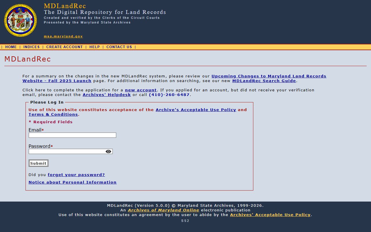
Search results in MDLandRec show the document type, recording date, grantor and grantee names, and a link to the scanned image. For certified copies of any instrument, contact the Cecil County Circuit Court Clerk's office in Elkton directly.
Cecil County SDAT Assessments
The State Department of Assessments and Taxation assigns Cecil County the SDAT code 08. The local SDAT supervisor is Jayme Dunn. The office phone is (410) 996-2760, and the email is sdat.cec@maryland.gov. SDAT is the agency that sets assessed values for all real property in Cecil County, and those values are used by both the state and the county to calculate annual property tax bills.
Cecil County assessments follow the statewide three-year cycle. Every three years, SDAT reviews the value of each parcel in Cecil County and may adjust it up or down based on market conditions. When a new assessment notice arrives, property owners have 45 days to appeal. The appeal goes first to the supervisor of assessments level, and if you are still not satisfied, you can take it to the Property Tax Assessment Appeals Board for Cecil County and then to the Maryland Tax Court if needed.
The screenshot below shows the SDAT Real Property Search tool, where any Cecil County parcel can be looked up by address or account number.
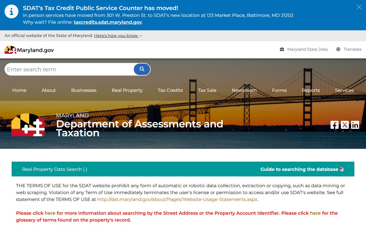
The SDAT search tool does not allow lookups by owner name. You can search by street address, account number, or map and parcel reference for Cecil County properties. Each result shows the assessed value, owner name, and tax account details.
Cecil County has one of the lowest recordation tax rates in Maryland at 0.82%. Many counties charge 1.0% or more. When combined with the 0.5% local transfer tax and the 0.5% state transfer tax, the total recording-related cost for a typical Cecil County transaction runs around 1.82% of the sale price. First-time homebuyers purchasing a primary residence pay only 0.25% state transfer tax instead of 0.5%, which reduces the total further. These rates make Cecil County attractive for buyers comparing costs across the Maryland-Delaware border region. Cecil County borders both Delaware and Pennsylvania, and buyers from those states sometimes compare costs carefully before deciding where to close.
SDAT also administers the Homestead Tax Credit, which limits annual assessment increases for owner-occupied homes in Cecil County. Once approved, this credit stays with the property as long as it is your primary residence. The Homeowners Tax Credit provides additional relief for income-qualifying owners. Applications for both are handled through SDAT at dat.maryland.gov.
Cecil County Plat Maps
Plat maps for Cecil County subdivisions are searchable through PLATS.net. This service covers subdivision plats recorded at the Circuit Court and provides lot-level boundary information, easements, and referenced bearings. PLATS.net is used by title searchers, surveyors, and buyers who want to understand parcel layout before a purchase in Cecil County.
The screenshot below shows the PLATS.net interface used to access Cecil County subdivision plat maps.
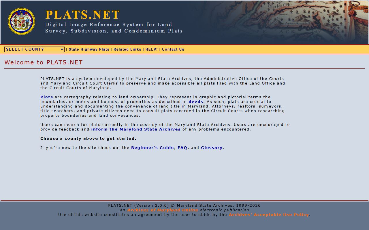
Use the public login (username: plato, password: plato#) to access plat records for Cecil County. You can search by subdivision name or browse by plat book and page number.
Cecil County has waterfront properties along the Chesapeake and Delaware Canal and the Elk River. Plats for these areas often include setback lines and riparian rights notes. If you are buying waterfront land in Cecil County, review the plat carefully for any recorded easements or access restrictions along the water's edge. Plats are also a good starting point before ordering a survey.
Historical Property Records in Cecil County
Cecil County was established in 1674, making it one of Maryland's oldest counties. Historical land records from the colonial and early American periods are held at the Maryland State Archives in Annapolis. Many of these older documents are indexed and scanned. The Archives at 350 Rowe Blvd, Annapolis, MD 21401 can be reached at (410) 260-6400.
The screenshot below shows the Maryland State Archives site, which is the entry point for older Cecil County land records not found in MDLandRec.

Remote research requests are available for a fee. In-person visits to the Archives give you access to finding aids and staff assistance for Cecil County historical land research.
Elkton, the county seat, sits at the head of the Elk River near the Delaware border. Cecil County's position at Maryland's northeastern tip means its land records have long reflected cross-border ownership patterns. Some landowners held parcels in both Maryland and Delaware, and deed chains for older properties may cross state lines. When researching title in Cecil County, especially near the state line, a search of Delaware land records may also be warranted depending on the history of the parcel.
Recording Documents in Cecil County
All deeds and other instruments that transfer or encumber real property in Cecil County must be recorded with the Clerk of the Circuit Court in Elkton. The courthouse is at 129 E. Main Street, Elkton, MD 21921. Before the Clerk can record your document, it must go through the Finance office for the recordation tax stamp. This two-step process is standard across most Maryland counties and applies in Cecil County as well.
The base recording fee in Maryland is $20 for the first two pages, $5 for each additional page, and a $75 surcharge that applies to most instruments. The Cecil County recordation tax of 0.82% is calculated on the consideration amount stated in the deed. For a $300,000 sale, the recordation tax alone would be $2,460. The 0.5% local transfer tax adds another $1,500. The state transfer tax of 0.5% adds $1,500 more. Total recording-related costs for that transaction would be roughly $5,460 plus the base filing fees.
Ground rents are less common in Cecil County than in Baltimore, but they do exist on some older properties. Under Real Property Article § 8-703, owners of ground rent leases must register them with SDAT. Buyers of Cecil County property should check both the deed and SDAT records to confirm whether a ground rent applies before closing.
Cities in Cecil County
Cecil County communities include Elkton, Perryville, North East, Chesapeake City, and Rising Sun. None of Cecil County's cities currently exceed the population threshold for a dedicated city page here, but all property records for these areas are filed and maintained at the Cecil County Circuit Court Clerk in Elkton.
Nearby Counties
Cecil County sits at Maryland's northeastern corner, bordered by counties to the south and west. If you are researching land near county boundaries, these neighboring jurisdictions also maintain their own land records.